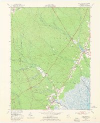
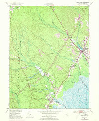
1951 Map of West Creek
USGS Topo · Published 1966About this map
Cranberry Bogs and extensive wetlands dominate the landscape between the coastal settlements and the interior pine barrens at the start of the 1950s. This survey records a critical moment in the region's modernization as the Garden State Parkway is shown under construction, cutting a diagonal swath through the Bass River State Forest. While the new highway signaled a shift toward increased accessibility, the established local economy is still visible through landmarks like Stafford Forge and the numerous named bogs. Coastal life centers around established villages such as Manahawkin and West Creek, with recreational and utilitarian sites like the Lakeside Speedway and Staffordville Public Landing providing insight into mid-century community focal points. Genealogists will find value in the placement of the Township Sch and the Cedar Run Cem, which anchor the small hamlets of Mayetta and Staffordville.
Find a feature on this map
37 named features on this map. Tap any name to fly to it.
Don’t see what you’re looking for? This feature index may not catch every label — zoom into the map to look around manually.
Map Details
Editions of this 1951 West Creek Map
5 editions found
Other maps of this area

1884 · Whitings
USGS Topo · 1:62,500

1888 · Barnegat
USGS Topo · 1:62,500

1888 · Little Egg Harbor
USGS Topo · 1:62,500

1888 · Long Beach
USGS Topo · 1:62,500

1888 · Whitings
USGS Topo · 1:62,500

1893 · Little Egg Harbor
USGS Topo · 1:62,500

1893 · Long Beach
USGS Topo · 1:62,500

1893 · Barnegat
USGS Topo · 1:62,500

1898 · Barnegat
USGS Topo · 1:62,500

1919 · Long Beach
USGS Topo · 1:62,500
Featured Places
- Stafford Township, NJ
- Barnegat Township, NJ
- Little Egg Harbor Township, NJ
- Eagleswood Township, NJ
- Staffordville, Eagleswood Township