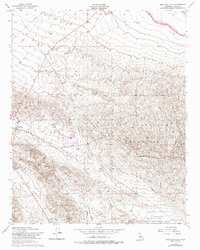
1954 Map of West Elk Hills
USGS Topo · Published 1976About this map
Naval Petroleum Reserve No 1 and Naval Petroleum Reserve No 2 dominate this industrial landscape in Kern County, illustrating the strategic importance of this oil-producing region. The 1954 data, updated with 1973 revisions, reveals an extensive network of oil wells, tanks, and sumps concentrated around McKittrick and Derby Acres. The topography is defined by the sharp transition from the elevated Elk Hills down into the McKittrick Valley and Buena Vista Valley. Water management infrastructure is prominent along the northern margin, where the California Aqueduquct and Kern R Flood Canal cut across the arid terrain near the Lokern Pumping Station. Transportation history is preserved through labels for the Old Railroad Grade and the winding Skyline Road, which provide a record of the logistical routes developed to service the surrounding energy fields and the community of Derby Acres.
Find a feature on this map
21 named features on this map. Tap any name to fly to it.
Don’t see what you’re looking for? This feature index may not catch every label — zoom into the map to look around manually.
Map Details
Editions of this 1954 West Elk Hills Map
3 editions found
Other maps of this area

1910 · Buena Vista Lake
USGS Topo · 1:125,000

1912 · McKittrick
USGS Topo · 1:125,000

1912 · Buena Vista Lake
USGS Topo · 1:125,000

1931 · Lokern
USGS Topo · 1:31,680

1932 · West Elk Hills
USGS Topo · 1:31,680

1932 · East Elk Hills
USGS Topo · 1:31,680
1932 · Buttonwillow
USGS Topo · 1:31,680

1934 · Lokern
USGS Topo · 1:31,680
1942 · Buttonwillow
USGS Topo · 1:62,500
1943 · Belridge
USGS Topo · 1:31,680