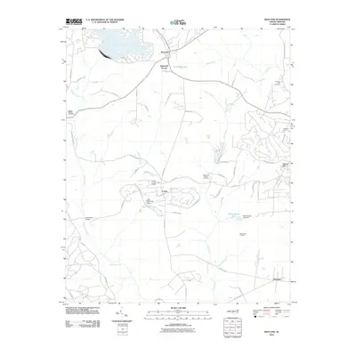
2010 Map of West End
USGS Topo · Published 2010About this map
West End and the surrounding Moore County landscape are defined by a network of creeks and small residential communities. This 2010 survey highlights the growth of the Foxfire community, where the Foxfire Country Club Airpark serves as a central landmark amidst a winding road system. The terrain is marked by significant water features including Lake McKenzie, Sandy Woods Lake, and the larger Von Canon Lake to the north.
Find a feature on this map
60 named features on this map. Tap any name to fly to it.
Don’t see what you’re looking for? This feature index may not catch every label — zoom into the map to look around manually.
Map Details
Editions of this 2010 West End Map
This is the sole edition of this map. No revisions or reprints were ever made.
Other maps of this area

1942 · Troy
USGS Topo · 1:125,000

1948 · Southern Pines
USGS Topo · 1:62,500

1948 · Pinebluff
USGS Topo · 1:24,000

1949 · Millstone Lake
USGS Topo · 1:24,000

1949 · West End
USGS Topo · 1:24,000

1949 · Hoffman
USGS Topo · 1:24,000

1949 · Jackson Springs
USGS Topo · 1:62,500

1950 · Pine Bluff
USGS Topo · 1:24,000

1950 · Southern Pines
USGS Topo · 1:24,000

1950 · Norman
USGS Topo · 1:24,000