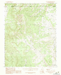
1983 Map of West Fork Rio Brazos
USGS Topo · Published 1983About this map
Tierra Amarilla defines the southwestern portion of this high-elevation landscape, where the border between New Mexico and Colorado intersects the continental drainage of the West Fork Rio Brazos. The region is characterized by a complex network of alpine watercourses including Arkansas Creek, Apache Creek, and Little Willow Creek. A notable feature of historical and engineering interest is the Cumbres & Toltec Scenic RR, which winds through the northern section of the map near the Osier Mesa. This narrow-gauge rail line remains a significant cultural landmark within the Carson National Forest. The map also delineates the Grant Boundary, illustrating the intersection of public forest lands with early land grants. Large expanses like Brazos Meadows and the surrounding national forests reflect the area's history as a hub for timber and resource management along the state line.
Find a feature on this map
21 named features on this map. Tap any name to fly to it.
Don’t see what you’re looking for? This feature index may not catch every label — zoom into the map to look around manually.
Map Details
Editions of this 1983 West Fork Rio Brazos Map
2 editions found
Other maps of this area

1913 · Summitville
USGS Topo · 1:125,000

1915 · Summitville
USGS Topo · 1:125,000

1918 · Tusas
USGS Topo · 1:125,000

1922 · Conejos
USGS Topo · 1:125,000

1945 · Durango
USGS Topo · 1:250,000

1953 · Durango
USGS Topo · 1:250,000

1954 · Durango
USGS Topo · 1:250,000

1954 · Aztec
USGS Topo · 1:250,000

1955 · Chama
USGS Topo · 1:62,500

1955 · Brazos Peak
USGS Topo · 1:62,500