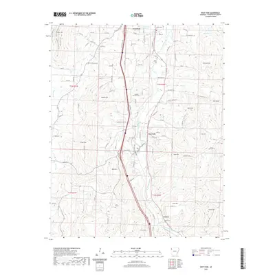
2020 Map of West Fork
USGS Topo · Published 2020About this map
The West Fork White River carves a path through the southern Ozark landscape, anchoring a series of small valley settlements including Greenland, West Fork, and Woolsey. This 2020 record of Washington County shows a topography defined by prominent ridges and peaks like Miller Mtn, Wasburn Mtn, and Bloyd Mtn. The map is particularly detailed regarding local burial grounds, documenting numerous sites such as Mineral Springs Cem and Baptist Ford Cem that offer significant value for genealogical research. The transportation network is a mix of established corridors and rural routes like Hogeye Fire Station Rd, reflecting the area's development. Numerous tributaries, including Winn Creek and Mill Cr, feed into the primary river system, illustrating the complex drainage patterns of the region's hilly terrain.
Find a feature on this map
113 named features on this map. Tap any name to fly to it.
Don’t see what you’re looking for? This feature index may not catch every label — zoom into the map to look around manually.
Map Details
Editions of this 2020 West Fork Map
This is the sole edition of this map. No revisions or reprints were ever made.
Other maps of this area

1898 · Winslow
USGS Topo · 1:125,000

1899 · Fayetteville
USGS Topo · 1:125,000

1901 · Winslow
USGS Topo · 1:125,000

1901 · Fayetteville
USGS Topo · 1:125,000

1904 · Fayetteville
USGS Topo · 1:125,000

1946 · Fort Smith
USGS Topo · 1:250,000

1954 · Tulsa
USGS Topo · 1:250,000

1958 · Fayetteville
USGS Topo · 1:24,000

1958 · Elkins
USGS Topo · 1:24,000

1958 · Tulsa
USGS Topo · 1:250,000