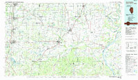
1984 Map of West Frankfort
USGS Topo · Published 1985About this map
Orient No. 2 Mine and Zeigler No. 4 Mine anchor a landscape defined by intensive resource extraction and heavy transport in the early 1980s. This survey records the industrial corridor connecting West Frankfort, Marion, and Harrisburg, where a dense network of rail lines including the Illinois Central Gulf RR and Burlington Northern RR served numerous active collieries. To the east, the terrain transitions into the Shawnee Hills, where the Saline River system winds toward its confluence with the Ohio River near Old Shawneetown. The presence of extensive oil fields and oil and gas fields near Omaha and Walpole highlights the region's diverse energy economy. Conservation areas like the Crab Orchard National Wildlife Refuge and Ferne Clyffe State Park provide a distinct contrast to the active mining and drilling operations that dominate the central plains.
Find a feature on this map
231 named features on this map. Tap any name to fly to it.
Don’t see what you’re looking for? This feature index may not catch every label — zoom into the map to look around manually.
Map Details
Editions of this 1984 West Frankfort Map
This is the sole edition of this map. No revisions or reprints were ever made.
Other maps of this area

1903 · New Harmony
USGS Topo · 1:62,500

1903 · Patoka
USGS Topo · 1:125,000

1905 · Eldorado
USGS Topo · 1:62,500

1905 · New Haven
USGS Topo · 1:62,500

1906 · New Haven
USGS Topo · 1:62,500

1906 · Eldorado
USGS Topo · 1:62,500

1907 · Morganfield
USGS Topo · 1:62,500

1908 · Galatia
USGS Topo · 1:62,500

1909 · Providence
USGS Topo · 1:62,500

1909 · West Frankfort
USGS Topo · 1:62,500