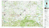
1987 Map of West Frankfort
USGS Topo · Published 1987About this map
The confluence of the Ohio River and Wabash River anchors the southeastern corner of this Illinois landscape, where riverfront commerce and industrial extraction shaped local development. During the late twentieth century, the region's economy is clearly defined by extensive Strip Mine operations concentrated between Harrisburg and Carriers Mills. This industrial footprint contrasts sharply with the protected terrain of the Shawnee National Forest and the Crab Orchard National Wildlife Refuge to the west, where the Big Muddy River system drains the agricultural and timbered uplands.
Find a feature on this map
102 named features on this map. Tap any name to fly to it.
Don’t see what you’re looking for? This feature index may not catch every label — zoom into the map to look around manually.
Map Details
Editions of this 1987 West Frankfort Map
This is the sole edition of this map. No revisions or reprints were ever made.
Other maps of this area

1903 · New Harmony
USGS Topo · 1:62,500

1903 · Patoka
USGS Topo · 1:125,000

1905 · Eldorado
USGS Topo · 1:62,500

1905 · New Haven
USGS Topo · 1:62,500

1906 · New Haven
USGS Topo · 1:62,500

1906 · Eldorado
USGS Topo · 1:62,500

1907 · Morganfield
USGS Topo · 1:62,500

1908 · Galatia
USGS Topo · 1:62,500

1909 · Providence
USGS Topo · 1:62,500

1909 · West Frankfort
USGS Topo · 1:62,500