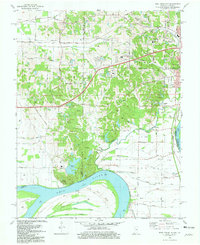
1981 Map of West Franklin
USGS Topo · Published 1981About this map
The Ohio River defines the southern boundary of this region, winding past Diamond Island and the small riverfront settlement of West Franklin. To the north, the landscape transitions from the agricultural lowlands of Cypress Slough and Big Pond into the rolling uplands of Marrs and Perry townships. The early 1980s infrastructure is dominated by the Louisville and Nashville railroad corridor, which links the suburban fringes of Evansville with outlying communities like St Philip and Belknap.
Find a feature on this map
63 named features on this map. Tap any name to fly to it.
Don’t see what you’re looking for? This feature index may not catch every label — zoom into the map to look around manually.
Map Details
Editions of this 1981 West Franklin Map
2 editions found
Other maps of this area

1901 · Haubstadt
USGS Topo · 1:62,500

1903 · Haubstadt
USGS Topo · 1:62,500

1903 · New Harmony
USGS Topo · 1:62,500

1903 · Patoka
USGS Topo · 1:125,000

1914 · Henderson
USGS Topo · 1:48,000

1916 · Henderson
USGS Topo · 1:62,500

1917 · Uniontown
USGS Topo · 1:62,500

1938 · New Harmony
USGS Topo · 1:62,500

1952 · Evansville
USGS Topo · 1:24,000
1952 · Henderson
USGS Topo · 1:24,000