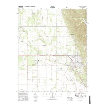
2017 Map of West Helena
USGS Topo · Published 2017About this map
West Helena and the surrounding Phillips County countryside are defined by the meeting of established agricultural lowlands and the wooded rises of the St. Francis National Forest. In this 2017 study, the landscape reveals a dense network of local history through its numerous burial grounds, such as Mount Pleasant Cem and Oak Grove Garden Cem, which anchor the smaller communities of Lexa, Southland, and Huma. The transition from the delta-like flatlands, drained by the Beaver Bayou Ditch and Caney Cr, to the higher ground of the forest is a primary geographical feature. The presence of the Thompson-Robbins Airport and various named road junctions like Wycamp and Pillar show the modern infrastructure layered over the older settlement patterns. Small water bodies like Storm Cr Lake and Crooked Cr wind through the hills, providing a sharp contrast to the straight-line drainage ditches that dominate the southwestern portion of the quadrangle.
Find a feature on this map
81 named features on this map. Tap any name to fly to it.
Don’t see what you’re looking for? This feature index may not catch every label — zoom into the map to look around manually.
Map Details
Editions of this 2017 West Helena Map
This is the sole edition of this map. No revisions or reprints were ever made.
Other maps of this area

1908 · Moon Lake
USGS Topo · 1:24,000

1912 · Moon Lake
USGS Topo · 1:31,680

1939 · Farrell
USGS Topo · 1:62,500

1939 · Modoc
USGS Topo · 1:62,500

1939 · Latour
USGS Topo · 1:62,500

1940 · Marvell
USGS Topo · 1:62,500

1948 · Helena
USGS Topo · 1:250,000

1948 · Modoc
USGS Topo · 1:62,500

1950 · Helena
USGS Topo · 1:250,000

1955 · Latour
USGS Topo · 1:62,500