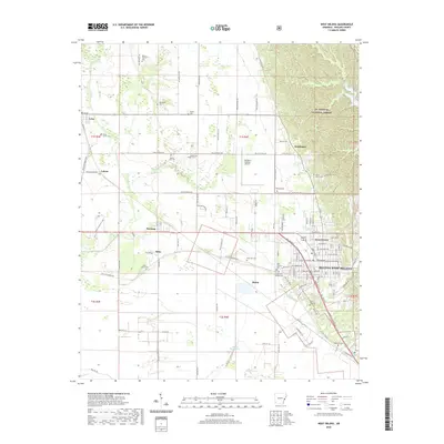
2020 Map of West Helena
USGS Topo · Published 2020About this map
The St. Francis National Forest dominates the northeastern reach of this Arkansas landscape, where the ridge terrain transitions into the alluvial plains of Phillips County. The development of Helena-West Helena is prominent in the east, characterized by a dense grid of streets and local landmarks including the Odd Fellows Cem and Oak Grove Garden Cem. The rural outskirts are defined by small settlements like Lexa, Wycamp, and Southland, reflecting a historical pattern of agriculture and small-town center growth. Aviation history is represented by the Thompson-Robbins Airport, while the landscape is carved by natural and engineered waterways such as Crooked Cr and the Beaver Bayou Ditch. Genealogists will find a wealth of local burial sites, including the family-named Polly Dots Cem and Stephens Cem, providing a detailed record of the area's rural heritage.
Find a feature on this map
88 named features on this map. Tap any name to fly to it.
Don’t see what you’re looking for? This feature index may not catch every label — zoom into the map to look around manually.
Map Details
Editions of this 2020 West Helena Map
This is the sole edition of this map. No revisions or reprints were ever made.
Other maps of this area

1908 · Moon Lake
USGS Topo · 1:24,000

1912 · Moon Lake
USGS Topo · 1:31,680

1939 · Farrell
USGS Topo · 1:62,500

1939 · Modoc
USGS Topo · 1:62,500

1939 · Latour
USGS Topo · 1:62,500

1940 · Marvell
USGS Topo · 1:62,500

1948 · Helena
USGS Topo · 1:250,000

1948 · Modoc
USGS Topo · 1:62,500

1950 · Helena
USGS Topo · 1:250,000

1955 · Latour
USGS Topo · 1:62,500