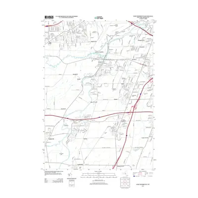
2013 Map of West Henrietta
USGS Topo · Published 2013About this map
The Genesee River carves a central path through this Monroe County landscape, serving as a geographic anchor for a network of modern transportation and long-standing settlements. In the northern section, the industrial and logistical footprint is heavy, defined by the Greater Rochester International Airport and the historical intersection at Genesee Junction. Moving south, the terrain transitions into a mix of residential clusters and dedicated open spaces, such as the Rush Reservoir and the ecologically distinct Cedar Swamp.
Find a feature on this map
46 named features on this map. Tap any name to fly to it.
Don’t see what you’re looking for? This feature index may not catch every label — zoom into the map to look around manually.
Map Details
Editions of this 2013 West Henrietta Map
This is the sole edition of this map. No revisions or reprints were ever made.
Other maps of this area

1895 · Rochester
USGS Topo · 1:62,500

1898 · Rochester
USGS Topo · 1:62,500

1899 · Brockport
USGS Topo · 1:62,500

1901 · Honeoye
USGS Topo · 1:62,500

1904 · Caledonia
USGS Topo · 1:62,500

1904 · Honeoye
USGS Topo · 1:62,500

1912 · Rochester
USGS Topo · 1:62,500

1920 · Rochester
USGS Topo · 1:62,500

1931 · Mendon Ponds
USGS Topo · 1:24,000

1931 · Rochester West
USGS Topo · 1:24,000