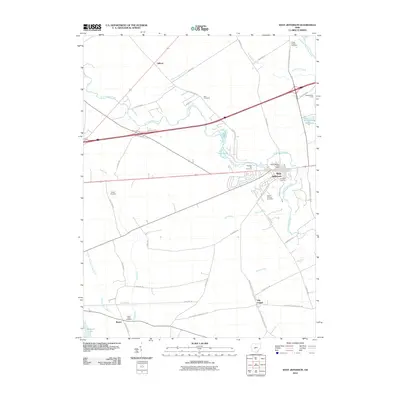
2010 Map of West Jefferson
USGS Topo · Published 2010About this map
West Jefferson serves as the primary hub in this portion of Madison County, situated at the junction of several historic transport routes. The village is densely marked with civic landmarks like the West Jefferson Post Office and local burial sites including Hampton Cemetery and Mount Calvary Cemetery. Outside the village center, the landscape is defined by the winding course of Little Darby Creek and an extensive network of drainage ditches such as Monroe Bidwell Ditch and Kent Ditch, which support the surrounding agricultural tracts. To the south, the settlement of Lilly Chapel sits near the Ohio-Erie Trl, while the western edge is anchored by the waters of Madison Lake at Rupert. This survey captures the rural character of the region, punctuated by family cemeteries like Wright Cemetery and Blair Cemetery that mark the locations of early area homesteads.
Find a feature on this map
47 named features on this map. Tap any name to fly to it.
Don’t see what you’re looking for? This feature index may not catch every label — zoom into the map to look around manually.
Map Details
Editions of this 2010 West Jefferson Map
This is the sole edition of this map. No revisions or reprints were ever made.
Other maps of this area

1901 · Dublin
USGS Topo · 1:62,500

1903 · Dublin
USGS Topo · 1:62,500

1907 · London
USGS Topo · 1:62,500

1916 · Milford Center
USGS Topo · 1:62,500

1923 · West Columbus
USGS Topo · 1:62,500

1925 · West Columbus
USGS Topo · 1:62,500

1944 · Milford Center
USGS Topo · 1:62,500

1947 · Columbus
USGS Topo · 1:250,000

1950 · Marion
USGS Topo · 1:250,000
1954 · Hilliard
USGS Topo · 1:24,000