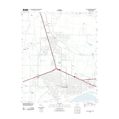
2011 Map of West Memphis
USGS Topo · Published 2011About this map
West Memphis and Marion anchor this 2011 survey, showing a landscape defined by the heavy infrastructure of the Arkansas-Tennessee border. The map illustrates a complex convergence of transit and industry, where the BNSF Railway and major interstate corridors intersect near the Mississippi River. Significant local landmarks include the Southland Park Racetrack and Riverside Speedway, alongside essential regional facilities like the West Memphis Municipal Airport.
Find a feature on this map
108 named features on this map. Tap any name to fly to it.
Don’t see what you’re looking for? This feature index may not catch every label — zoom into the map to look around manually.
Map Details
Editions of this 2011 West Memphis Map
This is the sole edition of this map. No revisions or reprints were ever made.
Other maps of this area

1916 · Memphis
USGS Topo · 1:62,500

1925 · Memphis
USGS Topo · 1:48,000

1927 · Memphis
USGS Topo · 1:62,500

1931 · Jericho
USGS Topo · 1:62,500

1939 · Jericho
USGS Topo · 1:62,500

1939 · Edmondson
USGS Topo · 1:62,500

1939 · Memphis
USGS Topo · 1:62,500

1940 · Deckerville
USGS Topo · 1:62,500

1952 · Jericho
USGS Topo · 1:62,500

1953 · Memphis
USGS Topo · 1:250,000