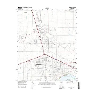
2014 Map of West Memphis
USGS Topo · Published 2014About this map
West Memphis and Marion form the heart of this Crittenden County study, situated just across the Mississippi River from Tennessee. The landscape is defined by the sharp transition between the developed residential and industrial grids of the cities and the sprawling alluvial lowlands of Lloyd Bottom. Notable watercourses like Fifteenmile Bayou and Tenmile Bayou snake through the terrain, illustrating the complex drainage patterns of the Delta region. Smaller communities and junctions, including Hulbert, Harvard, and Presley Junction, are scattered along the rail and road corridors, while the presence of Vice Presidents Island Number Forty-six shows the river's influence on the state boundary line. Infrastructure like the West Memphis Municipal Airport and the Burlington Northern Santa Fe RR highlight the area's role as a regional transportation hub near the state border.
Find a feature on this map
93 named features on this map. Tap any name to fly to it.
Don’t see what you’re looking for? This feature index may not catch every label — zoom into the map to look around manually.
Map Details
Editions of this 2014 West Memphis Map
This is the sole edition of this map. No revisions or reprints were ever made.
Other maps of this area

1916 · Memphis
USGS Topo · 1:62,500

1925 · Memphis
USGS Topo · 1:48,000

1927 · Memphis
USGS Topo · 1:62,500

1931 · Jericho
USGS Topo · 1:62,500

1939 · Jericho
USGS Topo · 1:62,500

1939 · Edmondson
USGS Topo · 1:62,500

1939 · Memphis
USGS Topo · 1:62,500

1940 · Deckerville
USGS Topo · 1:62,500

1952 · Jericho
USGS Topo · 1:62,500

1953 · Memphis
USGS Topo · 1:250,000