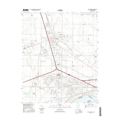
2017 Map of West Memphis
USGS Topo · Published 2017About this map
West Memphis and Marion dominate the landscape of eastern Arkansas along the bend of the Mississippi River. The region is defined by its complex hydrology, with Tenmile Bayou and Fifteenmile Bayou winding through the alluvial plains of Lloyd Bottom. This era shows significant educational and transit infrastructure, including the Arkansas State Univ Mid-South campus and the West Memphis Municipal Airport. Local history is preserved in sites like Pleasant Hill Cem and Saint Johns Cem, while smaller named communities such as Presley Junction, Wylie Spur, and Briark dot the outskirts of the larger urban centers. The massive river levee system and the presence of Vice Presidents Island Number Forty-six illustrate the engineering required to manage the river's influence on the surrounding Crittenden County terrain.
Find a feature on this map
57 named features on this map. Tap any name to fly to it.
Don’t see what you’re looking for? This feature index may not catch every label — zoom into the map to look around manually.
Map Details
Editions of this 2017 West Memphis Map
This is the sole edition of this map. No revisions or reprints were ever made.
Other maps of this area

1916 · Memphis
USGS Topo · 1:62,500

1925 · Memphis
USGS Topo · 1:48,000

1927 · Memphis
USGS Topo · 1:62,500

1931 · Jericho
USGS Topo · 1:62,500

1939 · Jericho
USGS Topo · 1:62,500

1939 · Edmondson
USGS Topo · 1:62,500

1939 · Memphis
USGS Topo · 1:62,500

1940 · Deckerville
USGS Topo · 1:62,500

1952 · Jericho
USGS Topo · 1:62,500

1953 · Memphis
USGS Topo · 1:250,000