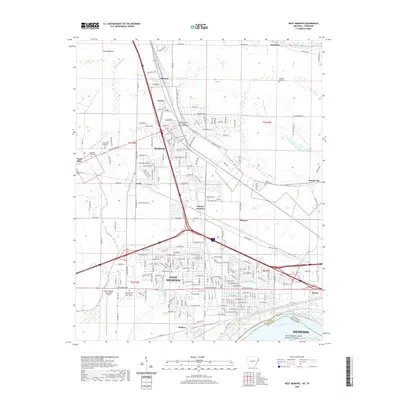
2020 Map of West Memphis
USGS Topo · Published 2020About this map
West Memphis and Marion anchor this detailed study of the Arkansas-Tennessee borderlands as they appeared in 2020. The landscape is defined by the sharp transition between dense urban corridors and the agricultural flats of the Mississippi Delta. The massive curve of the Mississippi River forms the southeastern boundary, while the interior is drained by a network of waterways including Tenmile Bayou and Fifteenmile Bayou. Transportation dominates the regional layout, with the Bnsf Railway and Union Pacific Railroad intersecting the heavily developed highway junctions that characterize this river-crossing hub.
Find a feature on this map
133 named features on this map. Tap any name to fly to it.
Don’t see what you’re looking for? This feature index may not catch every label — zoom into the map to look around manually.
Map Details
Editions of this 2020 West Memphis Map
This is the sole edition of this map. No revisions or reprints were ever made.
Other maps of this area

1916 · Memphis
USGS Topo · 1:62,500

1925 · Memphis
USGS Topo · 1:48,000

1927 · Memphis
USGS Topo · 1:62,500

1931 · Jericho
USGS Topo · 1:62,500

1939 · Jericho
USGS Topo · 1:62,500

1939 · Edmondson
USGS Topo · 1:62,500

1939 · Memphis
USGS Topo · 1:62,500

1940 · Deckerville
USGS Topo · 1:62,500

1952 · Jericho
USGS Topo · 1:62,500

1953 · Memphis
USGS Topo · 1:250,000