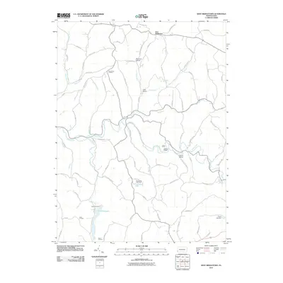
2010 Map of West Middletown
USGS Topo · Published 2010About this map
West Middletown sits at the northern edge of this Washington County landscape, a region defined by the winding course of Buffalo Creek and its many tributaries. The area is marked by numerous family and community landmarks, including Mount Hope Cemetery, Hupp Cemetery, and Rogers Cemetery, which provide essential points of reference for local genealogical research. Water management and recreation are central to the terrain, evidenced by Dutch Fork Lake and Stroughton Lake, both created by significant earthen structures like the Dutch Fork Dam and Stroughton Lake Dam. The map reveals a network of hollows and ridges, such as Opossum Hollow and Polecat Hollow, where small roads like Neely School Rd and Farrar School Rd hint at the locations of former rural schoolhouses. These features, along with Noble Bridge and Camp Buffalo, illustrate a rural Pennsylvania community balanced between agricultural heritage and modern water conservation efforts.
Find a feature on this map
71 named features on this map. Tap any name to fly to it.
Don’t see what you’re looking for? This feature index may not catch every label — zoom into the map to look around manually.
Map Details
Editions of this 2010 West Middletown Map
This is the sole edition of this map. No revisions or reprints were ever made.
Other maps of this area

1902 · Wheeling
USGS Topo · 1:62,500

1904 · Steubenville
USGS Topo · 1:62,500

1904 · Burgettstown
USGS Topo · 1:62,500

1906 · Burgettstown
USGS Topo · 1:62,500

1907 · Claysville
USGS Topo · 1:62,500

1935 · Wheeling
USGS Topo · 1:62,500

1935 · Steubenville
USGS Topo · 1:62,500

1942 · Wheeling
USGS Topo · 1:62,500

1942 · Steubenville
USGS Topo · 1:62,500

1951 · Canton
USGS Topo · 1:250,000
Featured Places
- Independence Township, PA
- West Middletown, PA
- Donegal Township, PA
- Blaine Township, PA
- Budaville, Donegal Township