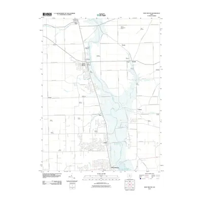
2010 Map of West Milton
USGS Topo · Published 2010About this map
The Stillwater River carves a deep central corridor through this Western Ohio landscape, anchoring a string of historic settlements from Ludlow Falls down to Englewood. The river's industrial legacy is marked by the West Milton Low Head Dam and a series of surrounding golf courses like the Stillwater Golf Course. This region is characterized by a dense network of family and community burial grounds, including the Old Milton Cemetery, Vore Cemetery, and the Honeyman Cemetery, which provide significant data points for genealogists tracking early families in the Miami Valley.
Find a feature on this map
68 named features on this map. Tap any name to fly to it.
Don’t see what you’re looking for? This feature index may not catch every label — zoom into the map to look around manually.
Map Details
Editions of this 2010 West Milton Map
This is the sole edition of this map. No revisions or reprints were ever made.
Other maps of this area

1904 · Dayton
USGS Topo · 1:62,500

1905 · Brookville
USGS Topo · 1:62,500

1906 · Dayton
USGS Topo · 1:62,500

1911 · Covington
USGS Topo · 1:62,500

1914 · Troy
USGS Topo · 1:62,500

1944 · Covington
USGS Topo · 1:62,500

1944 · Troy
USGS Topo · 1:62,500

1953 · Cincinnati
USGS Topo · 1:250,000

1953 · Muncie
USGS Topo · 1:250,000

1955 · West Milton
USGS Topo · 1:24,000