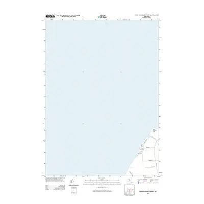
2013 Map of West Ninemile Point
USGS Topo · Published 2013About this map
Lake Ontario dominates the northern expanse of this 2013 survey, where the shoreline meets the terrestrial landscape at West Ninemile Point. This specific geography in Sterling, New York, reveals a quiet transition from the open waters of the Great Lakes to a coastal network of residential and access roads. The settlement at Moon Beach serves as a primary local focal point, situated just south of where Ninemile Cr empties into the lake. The transportation pattern, consisting of local routes like Marsh Rd and Ontario Shores Dr, indicates a landscape largely defined by seasonal or permanent lakeside residency and agricultural boundaries. The absence of heavy industrial or urban infrastructure emphasizes the rural, riparian character of this lakefront territory during the early 21st century.
Find a feature on this map
13 named features on this map. Tap any name to fly to it.
Don’t see what you’re looking for? This feature index may not catch every label — zoom into the map to look around manually.
Map Details
Editions of this 2013 West Ninemile Point Map
This is the sole edition of this map. No revisions or reprints were ever made.
Other maps of this area

1900 · Oswego
USGS Topo · 1:62,500

1902 · Sodus Bay
USGS Topo · 1:62,500

1943 · Oswego West
USGS Topo · 1:31,680

1943 · Hannibal
USGS Topo · 1:31,680

1943 · Fair Haven
USGS Topo · 1:31,680
1943 · North Wolcott
USGS Topo · 1:31,680
1943 · West Ninemile Point
USGS Topo · 1:31,680
1953 · North Wolcott
USGS Topo · 1:24,000
1954 · Hannibal
USGS Topo · 1:24,000
1954 · West Ninemile Point
USGS Topo · 1:24,000