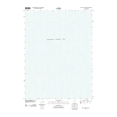
2011 Map of West of Big Pass
USGS Topo · Published 2011About this map
The Newfoundland Evaporation Basin dominates this landscape in western Utah, illustrating a specialized industrial use of the Great Salt Lake Desert. Situated in Tooele County, the area is defined by the hydrologic engineering of the West Desert Pumping Project. This 2011 survey by the U.S. Geological Survey shows a terrain transformed by evaporation ponds and salt management. Unlike the rugged mountain ranges typically found in the region, this quadrangle focuses almost entirely on the flat, aquatic, and mineral-rich expanse of the basin floor, serving as a record of human environmental modification in one of the most arid regions of the country.
Find a feature on this map
1 named feature on this map. Tap any name to fly to it.
Don’t see what you’re looking for? This feature index may not catch every label — zoom into the map to look around manually.
Map Details
Editions of this 2011 West of Big Pass Map
This is the sole edition of this map. No revisions or reprints were ever made.
Other maps of this area

1953 · Tooele
USGS Topo · 1:250,000

1954 · Brigham City
USGS Topo · 1:250,000

1955 · Tooele
USGS Topo · 1:250,000

1958 · Brigham City
USGS Topo · 1:250,000

1962 · Brigham City
USGS Topo · 1:250,000

1973 · Knolls 2 NW
USGS Topo · 1:24,000

1973 · Floating Island NE
USGS Topo · 1:24,000
1973 · Floating Island
USGS Topo · 1:24,000
1979 · Bonneville Salt Flats
USGS Topo · 1:100,000
1983 · Lucin 4 SW
USGS Topo · 1:24,000