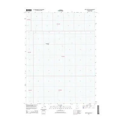
2014 Map of West of Big Pass
USGS Topo · Published 2014About this map
Newfoundland Evaporation Basin dominates this landscape in the western reaches of the state, where industrial salt extraction defines the geography. The basin's vast, gridded footprint stretches across townships including t4n r15w and t5n r15w, reflecting the large-scale management of mineral resources in the Great Salt Lake desert region. This 2014 survey documents the expansive infrastructure required for evaporation processes, illustrating the intersection of natural desert depressions and modern commercial resource recovery. The absence of traditional settlements or roads highlights the specialized, industrial nature of this territory, which is partitioned by the Public Land Survey System into a series of uniform sections and township blocks.
Find a feature on this map
7 named features on this map. Tap any name to fly to it.
Don’t see what you’re looking for? This feature index may not catch every label — zoom into the map to look around manually.
Map Details
Editions of this 2014 West of Big Pass Map
This is the sole edition of this map. No revisions or reprints were ever made.
Other maps of this area

1953 · Tooele
USGS Topo · 1:250,000

1954 · Brigham City
USGS Topo · 1:250,000

1955 · Tooele
USGS Topo · 1:250,000

1958 · Brigham City
USGS Topo · 1:250,000

1962 · Brigham City
USGS Topo · 1:250,000

1973 · Knolls 2 NW
USGS Topo · 1:24,000

1973 · Floating Island NE
USGS Topo · 1:24,000
1973 · Floating Island
USGS Topo · 1:24,000
1979 · Bonneville Salt Flats
USGS Topo · 1:100,000
1983 · Lucin 4 SW
USGS Topo · 1:24,000