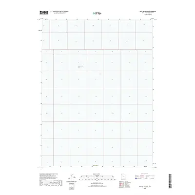
2020 Map of West of Big Pass
USGS Topo · Published 2020About this map
Newfoundland Evaporation Basin dominates the center of this remote landscape along the border of Box Elder Co. This survey illustrates the specialized industrial use of the western desert's saline environment during the early twenty-first century. The map is primarily characterized by the public land survey system grid, showing the systematic division of sections across a terrain defined by its water management infrastructure. Located west of the Great Salt Lake, this area reflects the intersection of natural salt flats and commercial evaporation processes, a key component of the region's mineral industry. The lack of traditional settlements or roads highlights the isolation of this specialized industrial site within the desert basin.
Find a feature on this map
2 named features on this map. Tap any name to fly to it.
Don’t see what you’re looking for? This feature index may not catch every label — zoom into the map to look around manually.
Map Details
Editions of this 2020 West of Big Pass Map
This is the sole edition of this map. No revisions or reprints were ever made.
Other maps of this area

1953 · Tooele
USGS Topo · 1:250,000

1954 · Brigham City
USGS Topo · 1:250,000

1955 · Tooele
USGS Topo · 1:250,000

1958 · Brigham City
USGS Topo · 1:250,000

1962 · Brigham City
USGS Topo · 1:250,000

1973 · Knolls 2 NW
USGS Topo · 1:24,000

1973 · Floating Island NE
USGS Topo · 1:24,000
1973 · Floating Island
USGS Topo · 1:24,000
1979 · Bonneville Salt Flats
USGS Topo · 1:100,000
1983 · Lucin 4 SW
USGS Topo · 1:24,000