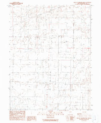
1990 Map of West of Christina Peak
USGS Topo · Published 1990About this map
Diamond Valley defines this arid stretch of central Nevada, where the land-use patterns of the late twentieth century center on resource extraction and water management. Numerous points marked as Well and scattered Stock Ponds reveal the infrastructure necessary for sustaining livestock in this environment. The northern portion of the map is crossed by the Express Trail, a historic transit corridor that predates the modern 4wd tracks and unimproved roads. Industrial activity is concentrated in the eastern and southern areas, evidenced by several Gravel Pits and Prospects. This provisional study captures a landscape of utility, where the vastness of the valley is punctuated by specific interventions—be it a lone Spring or the grid-like system of a sectioned interior, illustrating the sparse but vital human imprint on the Great Basin.
Find a feature on this map
12 named features on this map. Tap any name to fly to it.
Don’t see what you’re looking for? This feature index may not catch every label — zoom into the map to look around manually.
Map Details
Editions of this 1990 West of Christina Peak Map
This is the sole edition of this map. No revisions or reprints were ever made.
Other maps of this area

1926 · Roberts Mountains
USGS Topo · 1:250,000

1929 · Roberts Mountains
USGS Topo · 1:250,000

1949 · Garden Valley
USGS Topo · 1:62,500

1951 · Garden Valley
USGS Topo · 1:62,500

1953 · Eureka
USGS Topo · 1:62,500

1955 · Millett
USGS Topo · 1:250,000

1956 · Whistler Mtn
USGS Topo · 1:62,500

1956 · Ely
USGS Topo · 1:250,000

1957 · Diamond Springs
USGS Topo · 1:62,500

1959 · Ely
USGS Topo · 1:250,000