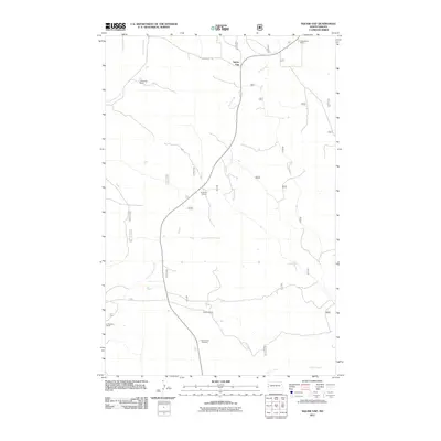
2011 Map of West of Flat Rock Butte
USGS Topo · Published 2011About this map
Sunny Side Cemetery and several established homesteads define this rural landscape in western North Dakota, just east of the Montana border. The settlement pattern is characterized by scattered cattle ranches including the Teschier Ranch, M Leland Ranch, and both the J Wheeling Ranch and H Wheeling Ranch. These sites are linked by a network of rural routes such as W Squaw Gap Rd and various forest service roads. The drainage of the area is carved by several seasonal watercourses, most notably Spring Creek, One-O-One Creek, and Poison Spring Creek. Centered around the small community of Squaw Gap, the map reveals a remote ranching economy where family names are permanently etched into the land's geography through their ranching operations.
Find a feature on this map
12 named features on this map. Tap any name to fly to it.
Don’t see what you’re looking for? This feature index may not catch every label — zoom into the map to look around manually.
Map Details
Editions of this 2011 West of Flat Rock Butte Map
This is the sole edition of this map. No revisions or reprints were ever made.
Other maps of this area

1909 · Glendive
USGS Topo · 1:250,000

1953 · Watford City
USGS Topo · 1:250,000

1954 · Glendive
USGS Topo · 1:250,000

1957 · Glendive
USGS Topo · 1:250,000

1957 · Watford City
USGS Topo · 1:250,000

1958 · Glendive
USGS Topo · 1:250,000

1967 · Watford City
USGS Topo · 1:250,000

1972 · Sidney SE
USGS Topo · 1:24,000
1972 · Phillip Spring
USGS Topo · 1:24,000

1972 · Sheep Creek
USGS Topo · 1:24,000