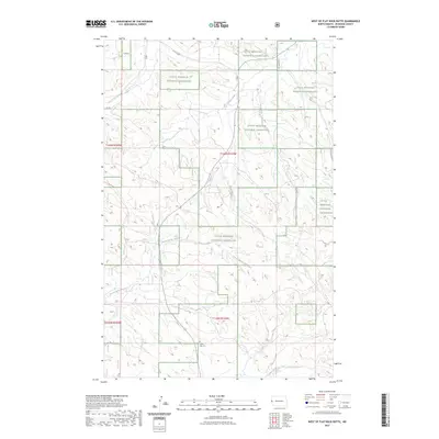
2023 Map of West of Flat Rock Butte
USGS Topo · Published 2023About this map
Sunny Side Cem sits near the southern edge of this McKenzie County landscape, providing a quiet marker of early settlement within the sprawling public lands of the Little Missouri National Grassland. The terrain is defined by a network of drainage systems, most notably Poison Spring Creek and One-O-One Creek, which reveal the erosive patterns typical of the North Dakota badlands region. While modern designations like 101 Rd and 15th St NW provide a contemporary grid for navigation, the natural topography remains the dominant feature. The map details the transition between township ranges, specifically t146n r105w and t145n r104w, where the semi-arid environment is shaped by watercourses like Spring Creek and O'Neil Creek.
Find a feature on this map
13 named features on this map. Tap any name to fly to it.
Don’t see what you’re looking for? This feature index may not catch every label — zoom into the map to look around manually.
Map Details
Editions of this 2023 West of Flat Rock Butte Map
This is the sole edition of this map. No revisions or reprints were ever made.
Other maps of this area

1909 · Glendive
USGS Topo · 1:250,000

1953 · Watford City
USGS Topo · 1:250,000

1954 · Glendive
USGS Topo · 1:250,000

1957 · Glendive
USGS Topo · 1:250,000

1957 · Watford City
USGS Topo · 1:250,000

1958 · Glendive
USGS Topo · 1:250,000

1967 · Watford City
USGS Topo · 1:250,000

1972 · Sidney SE
USGS Topo · 1:24,000
1972 · Phillip Spring
USGS Topo · 1:24,000

1972 · Sheep Creek
USGS Topo · 1:24,000