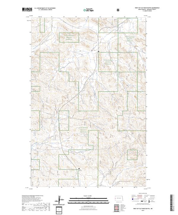
2024 Map of West of Flat Rock Butte
USGS Topo · Published 2024About this map
Little Missouri National Grassland dominates this landscape in McKenzie County, showing the intricate drainage patterns of the North Dakota badlands. The terrain is defined by the carved paths of One-O-One Creek and Poison Spring Creek, which cut through the high plains. For those researching local burial sites or family history, the Sunny Side Cem is a notable landmark located in the southern portion of the quadrangle. A sparse network of rural routes such as 15th St NW and Flat Rock Rd provides the primary access through this protected territory, highlighting the isolation and preservation of the grassland's interior. The map illustrates a region where the natural topography remains the primary focus, largely undisturbed by significant modern development or dense settlement.
Find a feature on this map
14 named features on this map. Tap any name to fly to it.
Don’t see what you’re looking for? This feature index may not catch every label — zoom into the map to look around manually.
Map Details
Editions of this 2024 West of Flat Rock Butte Map
This is the sole edition of this map. No revisions or reprints were ever made.
Other maps of this area

1909 · Glendive
USGS Topo · 1:250,000

1953 · Watford City
USGS Topo · 1:250,000

1954 · Glendive
USGS Topo · 1:250,000

1957 · Glendive
USGS Topo · 1:250,000

1957 · Watford City
USGS Topo · 1:250,000

1958 · Glendive
USGS Topo · 1:250,000

1967 · Watford City
USGS Topo · 1:250,000

1972 · Sidney SE
USGS Topo · 1:24,000
1972 · Phillip Spring
USGS Topo · 1:24,000

1972 · Sheep Creek
USGS Topo · 1:24,000