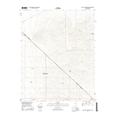
2014 Map of West of Gold Mountain
USGS Topo · Published 2014About this map
Death Valley National Park dominates this desert landscape where the state lines of California and Nevada converge. The map illustrates a high-desert environment defined by the transition between the Gold Mountain Range in the northeast and the Amargosa Range at the southern edge. The terrain is marked by significant elevation changes, with Death Valley and the Mojave Desert intersecting across a system of washes, most notably Oriental Wash in the northwest. This 2014 survey documents the precise boundary between Esmeralda and Inyo Counties, providing a clear look at the topography of this arid corridor before it descends into the lower basins of the park system.
Find a feature on this map
13 named features on this map. Tap any name to fly to it.
Don’t see what you’re looking for? This feature index may not catch every label — zoom into the map to look around manually.
Map Details
Editions of this 2014 West of Gold Mountain Map
This is the sole edition of this map. No revisions or reprints were ever made.
Other maps of this area

1908 · Lida
USGS Topo · 1:250,000

1913 · Lida
USGS Topo · 1:250,000

1954 · Goldfield
USGS Topo · 1:250,000

1955 · Goldfield
USGS Topo · 1:250,000

1957 · Magruder Mtn
USGS Topo · 1:62,500

1957 · Ubehebe Crater
USGS Topo · 1:62,500

1958 · Goldfield
USGS Topo · 1:250,000

1958 · Last Chance Range
USGS Topo · 1:62,500

1962 · Goldfield
USGS Topo · 1:250,000
1968 · Gold Point SW
USGS Topo · 1:24,000