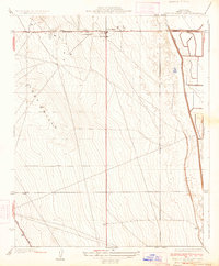
1934 Map of West of Goose Lake
USGS Topo · Published 1934About this map
Lost Hills occupies the northern edge of this Kern County survey, situated at the junction of the State Highway Paso Robles Road and the route heading south through the prominent ridge of the Lost Hills. The community is anchored by the Lost Hills Sch, serving a landscape defined by sharp topographic relief to the west and the engineered path of the West Side Canal to the east. This 1930s era topography shows the region during its development as a critical transportation corridor, with State Highway No 138 cutting through the southern portion of the quadrangle. The map captures a moment when the agricultural and transit infrastructure was being formalized, evidenced by the precise alignment of the canal and the emerging highway network.
Find a feature on this map
6 named features on this map. Tap any name to fly to it.
Don’t see what you’re looking for? This feature index may not catch every label — zoom into the map to look around manually.
Map Details
Editions of this 1934 West of Goose Lake Map
2 editions found

Other maps of this area

1912 · McKittrick
USGS Topo · 1:125,000

1914 · Lost Hills
USGS Topo · 1:125,000

1927 · Semitropic
USGS Topo · 1:31,680

1930 · Miramonte Ranch
USGS Topo · 1:31,680

1931 · Lokern
USGS Topo · 1:31,680

1931 · Goose Lake
USGS Topo · 1:31,680

1932 · Antelope Plain
USGS Topo · 1:31,680

1932 · West of Goose Lake
USGS Topo · 1:31,680

1932 · Reynolds Ranch
USGS Topo · 1:31,680

1934 · Lokern
USGS Topo · 1:31,680