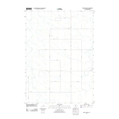
2012 Map of West of Ideal
USGS Topo · Published 2012About this map
Cottonwood Cr and Owl Cr carve delicate drainage patterns across this rural stretch of Tripp County, illustrating the sparse but organized agricultural landscape of south-central South Dakota. The topography is defined by a rigid section-line road grid, where long thoroughfares like 264th St and 304th Ave intersect at precise intervals. This layout reflects the enduring impact of the Public Land Survey System on the Great Plains, where the land was partitioned into a repeatable geometry to facilitate homesteading. The absence of concentrated town sites within this quadrangle emphasizes the area's identity as open range and farmland, where the few named natural features serve as the primary landmarks for navigation and land ownership.
Find a feature on this map
15 named features on this map. Tap any name to fly to it.
Don’t see what you’re looking for? This feature index may not catch every label — zoom into the map to look around manually.
Map Details
Editions of this 2012 West of Ideal Map
This is the sole edition of this map. No revisions or reprints were ever made.
Other maps of this area

1951 · Presho 4 NE
USGS Topo · 1:24,000

1951 · Ideal NW
USGS Topo · 1:24,000

1951 · Presho 4 NW
USGS Topo · 1:24,000

1955 · Martin
USGS Topo · 1:250,000

1955 · Mitchell
USGS Topo · 1:250,000

1958 · Martin
USGS Topo · 1:250,000

1959 · Mitchell
USGS Topo · 1:250,000

1982 · Presho 4 SE
USGS Topo · 1:25,000

1982 · Two Nation Creek
USGS Topo · 1:25,000

1982 · Witten
USGS Topo · 1:25,000