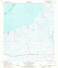
1957 Map of West of Johnson Bayou
USGS Topo · Published 1972About this map
Sabine Lake dominates the upper half of this coastal survey, where the brackish waters meet a complex network of marshland ridges in Cameron Parish. The landscape is defined by long, parallel cheniers—elevated sandy ridges that provided the only stable ground for travel and settlement in the coastal wetlands. These features, including Garrison Ridge, Sanders Ridge, and Blue Buck Ridge, show the traditional settlement patterns of the Louisiana coast before modern development altered the terrain.
Find a feature on this map
28 named features on this map. Tap any name to fly to it.
Don’t see what you’re looking for? This feature index may not catch every label — zoom into the map to look around manually.
Map Details
Editions of this 1957 West of Johnson Bayou Map
3 editions found
Other maps of this area

1932 · Sabine Pass NE
USGS Topo · 1:31,680

1932 · Port Arthur NE
USGS Topo · 1:31,680

1934 · Johnsons Bayou
USGS Topo · 1:24,000

1934 · Greens Bayou
USGS Topo · 1:24,000

1935 · Greens Bayou
USGS Topo · 1:31,680

1935 · Johnsons Bayou
USGS Topo · 1:31,680

1943 · West of Johnson Bayou
USGS Topo · 1:24,000

1943 · West of Greens Bayou
USGS Topo · 1:24,000

1943 · Port Arthur North
USGS Topo · 1:24,000

1943 · Port Arthur South
USGS Topo · 1:24,000