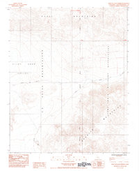
1984 Map of West of Leach Spring
USGS Topo · Published 1984About this map
Pilot Knob Valley serves as the central focal point of this Mojave Desert landscape, flanked by the Quail Mountains and the Granite Mountains. The 1984 survey reveals a region dominated by government land use, where the U S Naval Reservation and the Fort Irwin Military Reservation converge. The San Bernardino Meridian passes through the center of the sheet, providing a critical surveying baseline for the surrounding township and range divisions. Human movement through this arid environment is largely defined by Randsburg Road, which cuts across the valley floor. Myrick Spring stands out as a rare water source in the southern reaches of the quadrangle, a vital point for anyone tracing the natural history of this portion of San Bernardino County during the late twentieth century.
Find a feature on this map
12 named features on this map. Tap any name to fly to it.
Don’t see what you’re looking for? This feature index may not catch every label — zoom into the map to look around manually.
Map Details
Editions of this 1984 West of Leach Spring Map
2 editions found
Other maps of this area

1915 · Searles Lake
USGS Topo · 1:250,000

1933 · Avawatz Mountains
USGS Topo · 1:250,000

1947 · Trona
USGS Topo · 1:250,000

1948 · Trona
USGS Topo · 1:250,000

1948 · Quail Mountains
USGS Topo · 1:62,500

1948 · Goldstone Lake
USGS Topo · 1:62,500

1950 · Wingate Pass
USGS Topo · 1:62,500

1951 · Goldstone Lake
USGS Topo · 1:62,500

1951 · Wingate Pass
USGS Topo · 1:62,500

1951 · Quail Mountains
USGS Topo · 1:62,500