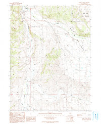
1990 Map of West of Lee
USGS Topo · Published 1991About this map
The South Fork Humboldt River and its major tributaries, Huntington Creek and Willow Creek, define the water-scarce landscape of this 1990 Elko County survey. This arid region of Nevada shows a pattern of land use centered on ranching and resource extraction, with the South Fork Indian Reservation occupying the eastern portion of the quadrangle. The map documents numerous mining and prospecting activities, evidenced by labels for Prospects, Adits, and various Gravel Pits scattered across the sagebrush and basin terrain.
Find a feature on this map
22 named features on this map. Tap any name to fly to it.
Don’t see what you’re looking for? This feature index may not catch every label — zoom into the map to look around manually.
Map Details
Editions of this 1990 West of Lee Map
This is the sole edition of this map. No revisions or reprints were ever made.
Other maps of this area

1934 · Jiggs
USGS Topo · 1:125,000

1937 · Jiggs
USGS Topo · 1:125,000

1952 · Dixie Flats
USGS Topo · 1:62,500

1955 · Elko
USGS Topo · 1:250,000

1956 · Robinson Mtn
USGS Topo · 1:62,500

1958 · Elko
USGS Topo · 1:250,000

1959 · Jiggs
USGS Topo · 1:62,500

1962 · Elko
USGS Topo · 1:250,000

1962 · Lee
USGS Topo · 1:62,500

1965 · Elko
USGS Topo · 1:250,000