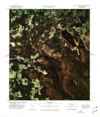
1978 Map of West of Norton Port of Entry
USGS Topo · Published 1978About this map
The international border between the Canada United States defines the center of this 1970s orthophoto image map, capturing a landscape of dense woodlands and secluded water bodies. To the north in Quebec, Baldwin Mills sits near the northern tip of Lyster Lake, while a Fish Hatchery is situated along the Niger River. The terrain is marked by significant elevations like Barnston Hill and Page Hill, with the southern portion of the image dominated by Holland Pond and the aptly named The Hurricane. Small settlements such as South Barnston and Heathton appear as clearings in the forest, connected by rural routes like Mountain Road. This specific survey, produced in cooperation with the U.S. Customs Service, provides a unique look at the remote terrain west of the Norton Port of Entry before modern development altered the woodland interfaces.
Find a feature on this map
24 named features on this map. Tap any name to fly to it.
Don’t see what you’re looking for? This feature index may not catch every label — zoom into the map to look around manually.
Map Details
Editions of this 1978 West of Norton Port of Entry Map
This is the sole edition of this map. No revisions or reprints were ever made.
Other maps of this area

1919 · Lake Memphremagog
USGS Topo · 1:62,500

1920 · Derby
USGS Topo · 1:62,500

1923 · Lake Memphremagog
USGS Topo · 1:48,000

1924 · Island Pond
USGS Topo · 1:48,000

1925 · Memphremagog
USGS Topo · 1:62,500

1926 · Island Pond
USGS Topo · 1:62,500

1949 · Jackman
USGS Topo · 1:250,000

1950 · Lake Champlain
USGS Topo · 1:250,000

1950 · Lewiston
USGS Topo · 1:250,000

1953 · Island Pond
USGS Topo · 1:62,500