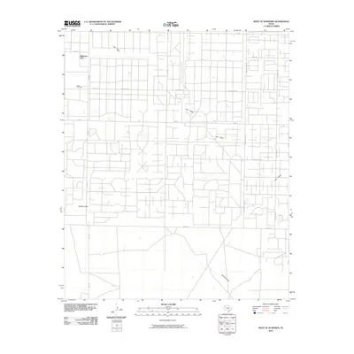
2010 Map of West of Sundown
USGS Topo · Published 2010About this map
Girlstown USA and its residential campus anchor the northwestern corner of this landscape, situated within a dense network of sectional roads and oil-related infrastructure in Hockley County. The terrain is defined by two prominent ephemeral watercourses, Lost Draw and Sulphur Draw, which carve shallow paths across the high plains. The road naming convention reflects the region's petroleum history and ranching identity, featuring thoroughfares such as Wildcat Rd, Roughneck Rd, and Sampson Post Rd. This layout reveals a land transitioned from open range to a highly organized industrial and agricultural grid. Local movement is facilitated by state-maintained routes like FM 1780 and FM 1585, which intersect a labyrinth of named tracks like Sagebrush Rd and Tumbleweed Rd, illustrating the intensive development of the Llano Estacado's mineral and land resources during this era.
Find a feature on this map
15 named features on this map. Tap any name to fly to it.
Don’t see what you’re looking for? This feature index may not catch every label — zoom into the map to look around manually.
Map Details
Editions of this 2010 West of Sundown Map
This is the sole edition of this map. No revisions or reprints were ever made.
Other maps of this area

1954 · Brownfield
USGS Topo · 1:250,000

1958 · Brownfield
USGS Topo · 1:250,000

1962 · Brownfield
USGS Topo · 1:250,000

1965 · Levelland West
USGS Topo · 1:24,000

1965 · Sundown
USGS Topo · 1:24,000

1965 · Plains 1 NE
USGS Topo · 1:24,000

1965 · Whiteface
USGS Topo · 1:24,000

1969 · Plains 1 SE
USGS Topo · 1:24,000

1969 · Pool
USGS Topo · 1:24,000

1970 · Plains 1 SW
USGS Topo · 1:24,000