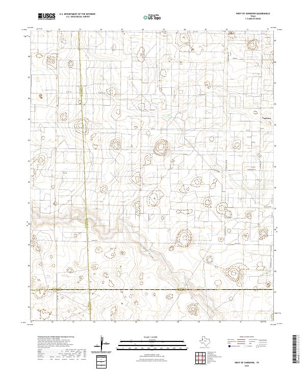
2022 Map of West of Sundown
USGS Topo · Published 2022About this map
Sulphur Draw and Lost Draw wind through this corner of the South Plains, marking the natural drainage patterns in an otherwise heavily managed agricultural and industrial landscape. The western edge of Sundown sits at the periphery of the map, while the surrounding area is defined by a dense grid of section roads and oil-field infrastructure. The nomenclature of the local road network—including Wildcat Rd, Roughneck Rd, and Polish Rod—points to the deep-rooted influence of the petroleum industry on the development of Hockley County. These labels reflect the functional heritage of the land as part of the Permian Basin's energy production history. The map also delineates the convergence of several county lines, where Cochran, Hockley, Yoakum, and Terry counties meet in a rare four-corner intersection of political boundaries.
Find a feature on this map
22 named features on this map. Tap any name to fly to it.
Don’t see what you’re looking for? This feature index may not catch every label — zoom into the map to look around manually.
Map Details
Editions of this 2022 West of Sundown Map
This is the sole edition of this map. No revisions or reprints were ever made.
Other maps of this area

1954 · Brownfield
USGS Topo · 1:250,000

1958 · Brownfield
USGS Topo · 1:250,000

1962 · Brownfield
USGS Topo · 1:250,000

1965 · Levelland West
USGS Topo · 1:24,000

1965 · Sundown
USGS Topo · 1:24,000

1965 · Plains 1 NE
USGS Topo · 1:24,000

1965 · Whiteface
USGS Topo · 1:24,000

1969 · Plains 1 SE
USGS Topo · 1:24,000

1969 · Pool
USGS Topo · 1:24,000

1970 · Plains 1 SW
USGS Topo · 1:24,000