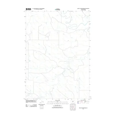
2012 Map of West of Westover
USGS Topo · Published 2012About this map
White River meanders across the northern portion of this South Dakota landscape, creating a complex series of oxbows and bends in the Swift Bear Segment of Mellette County. The terrain is defined by a sparse but intricate drainage network where Cottonwood Cr and Butch Cr carve through the plains. This 2012 survey illustrates the section-line road patterns typical of the region, where infrastructure is dictated by the vast, open geography of the High Plains. While settlements are not present on this specific sheet, the map serves as a primary source for understanding the hydrological and topographic character of the territory just west of the historic Westover crossing, showing the relationship between seasonal watercourses and the established grid of local roads.
Find a feature on this map
3 named features on this map. Tap any name to fly to it.
Don’t see what you’re looking for? This feature index may not catch every label — zoom into the map to look around manually.
Map Details
Editions of this 2012 West of Westover Map
This is the sole edition of this map. No revisions or reprints were ever made.
Other maps of this area

1951 · Okaton SW
USGS Topo · 1:24,000

1951 · Westover
USGS Topo · 1:24,000

1951 · Murdo SW
USGS Topo · 1:24,000

1951 · Murdo 3 NW
USGS Topo · 1:24,000

1951 · Murdo 3 NE
USGS Topo · 1:24,000

1951 · Okaton SE
USGS Topo · 1:24,000

1955 · Martin
USGS Topo · 1:250,000

1958 · Martin
USGS Topo · 1:250,000
1982 · Murdo 3 NW
USGS Topo · 1:25,000

1982 · White River East
USGS Topo · 1:24,000