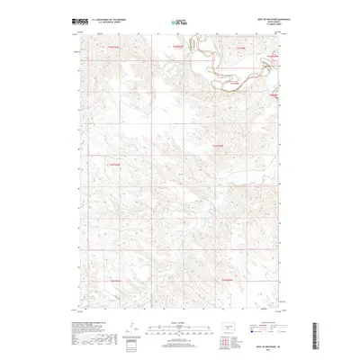
2017 Map of West of Westover
USGS Topo · Published 2017About this map
The White River winds through the northern portion of this South Dakota landscape, marking the boundary between Mellette Co and Jones Co. This region, characterized by its complex drainage networks and deep topographic relief, is defined by the systems of Cottonwood Cr and Butch Cr as they cut through the grassland. The terrain is sparsely developed, centered around the Ridgeway Rd corridor in the south. This map captures the vast public land survey system grid, reflecting the section-based organization of the Great Plains. The intricate contour lines reveal the erosion patterns typical of the river breaks, where the high prairie drops away into the valley of the White River.
Find a feature on this map
13 named features on this map. Tap any name to fly to it.
Don’t see what you’re looking for? This feature index may not catch every label — zoom into the map to look around manually.
Map Details
Editions of this 2017 West of Westover Map
This is the sole edition of this map. No revisions or reprints were ever made.
Other maps of this area

1951 · Okaton SW
USGS Topo · 1:24,000

1951 · Westover
USGS Topo · 1:24,000

1951 · Murdo SW
USGS Topo · 1:24,000

1951 · Murdo 3 NW
USGS Topo · 1:24,000

1951 · Murdo 3 NE
USGS Topo · 1:24,000

1951 · Okaton SE
USGS Topo · 1:24,000

1955 · Martin
USGS Topo · 1:250,000

1958 · Martin
USGS Topo · 1:250,000
1982 · Murdo 3 NW
USGS Topo · 1:25,000

1982 · White River East
USGS Topo · 1:24,000