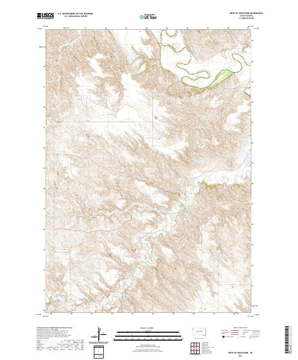
2021 Map of West of Westover
USGS Topo · Published 2021About this map
The White River winds across the northern reaches of this landscape, carving a complex system of breaks and drainage basins along the Jones Co Mellette Co boundary. The terrain is defined by the sharp relief of these badlands, where seasonal waterways like Butch Cr and Cottonwood Cr have eroded the plateau into a network of ridges and draws. This sparsely populated region reflects the vast ranching and open-range character of Mellette County, with few human imprints beyond the occasional gravel artery like Ridgeway Rd or 268th Ave. The map provides a look at the natural topographical detail of the northern Great Plains, emphasizing the intricate water-carved geography that dictates the placement of rural infrastructure and land use in South Dakota's river country.
Find a feature on this map
14 named features on this map. Tap any name to fly to it.
Don’t see what you’re looking for? This feature index may not catch every label — zoom into the map to look around manually.
Map Details
Editions of this 2021 West of Westover Map
This is the sole edition of this map. No revisions or reprints were ever made.
Other maps of this area

1951 · Okaton SW
USGS Topo · 1:24,000

1951 · Westover
USGS Topo · 1:24,000

1951 · Murdo SW
USGS Topo · 1:24,000

1951 · Murdo 3 NW
USGS Topo · 1:24,000

1951 · Murdo 3 NE
USGS Topo · 1:24,000

1951 · Okaton SE
USGS Topo · 1:24,000

1955 · Martin
USGS Topo · 1:250,000

1958 · Martin
USGS Topo · 1:250,000
1982 · Murdo 3 NW
USGS Topo · 1:25,000

1982 · White River East
USGS Topo · 1:24,000