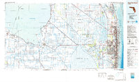
1985 Map of West Palm Beach
USGS Topo · Published 1986About this map
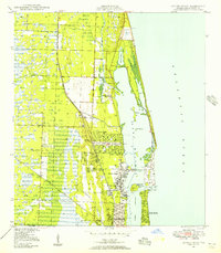
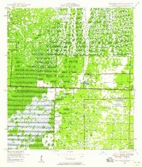
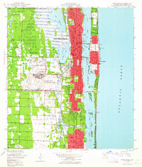
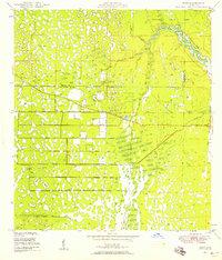
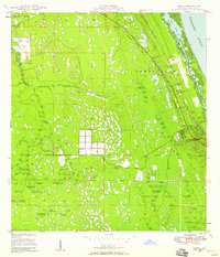
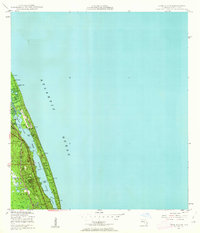
Lake Okeechobee and its vast network of reclamation canals define the western landscape of this mid-1980s survey. The map illustrates the intensive agricultural geometry surrounding Belle Glade, Pahokee, and Clewiston, where the St Lucie Canal and the Coast Line railroad served the regional economy. This inland grid contrasts sharply with the preserved wetlands of the Loxahatchee National Wildlife Refuge Conservation Area No 1 and the J. W. Corbett Wildlife Management Area. Along the Atlantic coast, the urbanization of the Gold Coast is fully realized from Juno Beach south through West Palm Beach and Lake Worth. The inclusion of bathymetric contours in the Atlantic Ocean and Lake Worth lagoon provides a rare look at the underwater topography of the Jupiter Inlet and offshore shoals during this period of significant coastal development.
Find a feature on this map
57 named features on this map. Tap any name to fly to it.
Don’t see what you’re looking for? This feature index may not catch every label — zoom into the map to look around manually.
Map Details
Editions of this 1985 West Palm Beach Map
This is the sole edition of this map. No revisions or reprints were ever made.
Other maps of this area
1945 · Delta
USGS Topo · 1:24,000
1945 · Greenacres City
USGS Topo · 1:24,000
1945 · Lake Worth
USGS Topo · 1:24,000
1946 · Riviera Beach
USGS Topo · 1:24,000
1946 · Palm Beach Farms
USGS Topo · 1:24,000
1946 · Palm Beach
USGS Topo · 1:24,000

1947 · Delmar Farms
USGS Topo · 1:24,000
1948 · Rood
USGS Topo · 1:24,000
1948 · Gomez
USGS Topo · 1:24,000
1948 · Hobe Sound
USGS Topo · 1:24,000