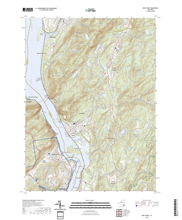
2023 Map of West Point
USGS Topo · Published 2023About this map
The West Point Military Reservation anchors this high-resolution survey of the Hudson Highlands, centered on the strategic narrows of the Hudson River. The landscape is dominated by the sprawling grounds of the United States Military Academy, where the river takes a sharp turn at Worlds End near Gees Point. This topography reveals the intense concentration of academic and tactical infrastructure at West Point, including Lusk Reservoir, Delafield Pond, and the West Point Cem.
Find a feature on this map
200 named features on this map. Tap any name to fly to it.
Don’t see what you’re looking for? This feature index may not catch every label — zoom into the map to look around manually.
Map Details
Editions of this 2023 West Point Map
This is the sole edition of this map. No revisions or reprints were ever made.
Other maps of this area

1892 · West Point
USGS Topo · 1:62,500

1893 · Poughkeepsie
USGS Topo · 1:62,500

1894 · West Point
USGS Topo · 1:62,500

1894 · Poughkeepsie
USGS Topo · 1:62,500

1899 · West Point
USGS Topo · 1:62,500

1901 · West Point
USGS Topo · 1:62,500

1902 · Schunemunk
USGS Topo · 1:62,500

1903 · Poughkeepsie
USGS Topo · 1:62,500

1903 · Newburg
USGS Topo · 1:62,500

1930 · Schunemunk
USGS Topo · 1:48,000