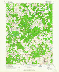
1963 Map of West Sunbury
USGS Topo · Published 1965About this map
West Sunbury and the surrounding townships of Marion, Cherry, and Brady define this 1963 landscape, where the local economy and geography were shaped by the Bessemer and Lake Erie Railroad Grade. The terrain is characterized by the winding courses of Slippery Rock Creek and its various branches, including the South Branch and North Branch. The map reveals an industrial pattern of numerous strip mines and tipples scattered across the hills, particularly near Branchton and Annandale.
Find a feature on this map
44 named features on this map. Tap any name to fly to it.
Don’t see what you’re looking for? This feature index may not catch every label — zoom into the map to look around manually.
Map Details
Editions of this 1963 West Sunbury Map
3 editions found
Other maps of this area

1908 · Zelienople
USGS Topo · 1:62,500

1909 · Butler
USGS Topo · 1:62,500

1910 · Zelienople
USGS Topo · 1:62,500

1910 · Hilliards
USGS Topo · 1:62,500

1911 · Butler
USGS Topo · 1:62,500

1912 · Hilliards
USGS Topo · 1:62,500

1913 · Mercer
USGS Topo · 1:62,500

1939 · Mercer
USGS Topo · 1:62,500

1943 · Mercer
USGS Topo · 1:62,500

1944 · Hilliards
USGS Topo · 1:62,500