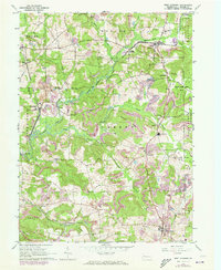
1963 Map of West Sunbury
USGS Topo · Published 1973About this map
Slippery Rock Creek and its various branches carve through this Butler County landscape, dictating the placement of small rural settlements and industrial sites during the mid-twentieth century. The Bessemer and Lake Erie Railroad follows the valley floor, connecting rail stops like Branchton and Boyers with the mining and agricultural activities of the region. Local life centers around a network of country churches and schools, such as New Hope Ch and Moniteau High Sch, while the presence of a Strip Mine and the sprawling State Game Lands No 95 indicate the dual economic reliance on resource extraction and managed wilderness. From Forestville in the northwest to West Sunbury in the southeast, the map reveals a community defined by the sinuous paths of Findley Run and the ridges separating these vital waterways.
Find a feature on this map
41 named features on this map. Tap any name to fly to it.
Don’t see what you’re looking for? This feature index may not catch every label — zoom into the map to look around manually.
Map Details
Editions of this 1963 West Sunbury Map
3 editions found
Other maps of this area

1908 · Zelienople
USGS Topo · 1:62,500

1909 · Butler
USGS Topo · 1:62,500

1910 · Zelienople
USGS Topo · 1:62,500

1910 · Hilliards
USGS Topo · 1:62,500

1911 · Butler
USGS Topo · 1:62,500

1912 · Hilliards
USGS Topo · 1:62,500

1913 · Mercer
USGS Topo · 1:62,500

1939 · Mercer
USGS Topo · 1:62,500

1943 · Mercer
USGS Topo · 1:62,500

1944 · Hilliards
USGS Topo · 1:62,500