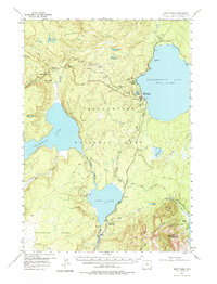
1956 Map of West Thumb
USGS Topo · Published 1975About this map
Yellowstone Lake (West Thumb) serves as the geographic anchor for this mid-century topographic survey, where the Continental Divide weaves across the high-altitude volcanic plateau. The map captures a detailed inventory of hydrothermal activity, pinpointing the West Thumb Geyser Basin, Potts Hot Spring Basin, and the Thumb Paintpots along the shoreline. Thermal features extend deep into the wilderness, including the Heart Lake Geyser Basin near the foot of Mount Sheridan and Rustic Geyser further south.
Find a feature on this map
56 named features on this map. Tap any name to fly to it.
Don’t see what you’re looking for? This feature index may not catch every label — zoom into the map to look around manually.
Map Details
Editions of this 1956 West Thumb Map
3 editions found
Other maps of this area

1885 · Lake
USGS Topo · 1:125,000

1885 · Gallatin
USGS Topo · 1:125,000

1885 · Gallatin
USGS Topo · 1:125,000

1886 · Shoshone
USGS Topo · 1:125,000

1886 · Canyon
USGS Topo · 1:125,000

1888 · Shoshone
USGS Topo · 1:125,000

1895 · Shoshone
USGS Topo · 1:125,000

1895 · Canyon
USGS Topo · 1:125,000

1895 · Lake
USGS Topo · 1:125,000

1896 · Lake
USGS Topo · 1:125,000