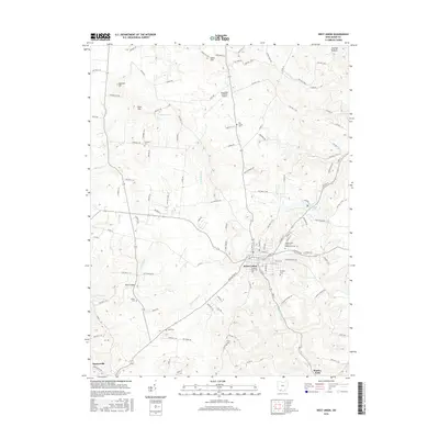
2016 Map of West Union
USGS Topo · Published 2016About this map
West Union serves as the central hub of this Adams County landscape, where the local street grid meets the winding corridors of Lick Fork and Hannah Run. The town is bordered by several significant burial grounds, including the Pumpkin Ridge Cem and the Independent Order of Oddfellows Cem, reflecting the deep-seated community history of the region. To the north, Adams Lake provides a notable water feature near the Alexander Salamon Airport.
Find a feature on this map
115 named features on this map. Tap any name to fly to it.
Don’t see what you’re looking for? This feature index may not catch every label — zoom into the map to look around manually.
Map Details
Editions of this 2016 West Union Map
This is the sole edition of this map. No revisions or reprints were ever made.
Other maps of this area

1916 · Peebles
USGS Topo · 1:62,500

1918 · Peebles
USGS Topo · 1:62,500

1918 · Seaman
USGS Topo · 1:62,500

1919 · Vanceburg
USGS Topo · 1:62,500

1929 · Springdale
USGS Topo · 1:48,000

1935 · Springdale
USGS Topo · 1:62,500

1949 · Vanceburg
USGS Topo · 1:62,500

1949 · Concord
USGS Topo · 1:24,000
1951 · Concord
USGS Topo · 1:24,000

1952 · Maysville East
USGS Topo · 1:24,000