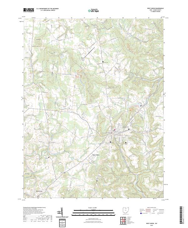
2023 Map of West Union
USGS Topo · Published 2023About this map
West Union serves as the focal point of this Adams County landscape, centered on the Adams County Courthouse and its surrounding street grid. The town's layout transitions from urban blocks to a countryside defined by deep drainages like East Fork Eagle Creek and Lick Fork. This modern record reveals a dense concentration of lineage markers, including the Independent Order of Oddfellows Cem and several family-named burial sites such as the Lepley Family Cem and Nixon Cem.
Find a feature on this map
84 named features on this map. Tap any name to fly to it.
Don’t see what you’re looking for? This feature index may not catch every label — zoom into the map to look around manually.
Map Details
Editions of this 2023 West Union Map
This is the sole edition of this map. No revisions or reprints were ever made.
Other maps of this area

1916 · Peebles
USGS Topo · 1:62,500

1918 · Peebles
USGS Topo · 1:62,500

1918 · Seaman
USGS Topo · 1:62,500

1919 · Vanceburg
USGS Topo · 1:62,500

1929 · Springdale
USGS Topo · 1:48,000

1935 · Springdale
USGS Topo · 1:62,500

1949 · Vanceburg
USGS Topo · 1:62,500

1949 · Concord
USGS Topo · 1:24,000
1951 · Concord
USGS Topo · 1:24,000

1952 · Maysville East
USGS Topo · 1:24,000