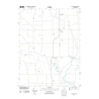
2011 Map of West Union
USGS Topo · Published 2011About this map
The Wabash River forms a defining eastern boundary for this agricultural region, creating a distinctive hydrological landscape at the York Cutoff. The small riverfront settlement of York sits just north of this bend, while the inland communities of West Union and West York anchor the local road network. The rural character of the area is underscored by the high density of family and community burial grounds, such as Harrison Cemetery, Shawler Cemetery, and Musgrave Cemetery, which serve as vital landmarks for genealogists tracing early residents.
Find a feature on this map
31 named features on this map. Tap any name to fly to it.
Don’t see what you’re looking for? This feature index may not catch every label — zoom into the map to look around manually.
Map Details
Editions of this 2011 West Union Map
This is the sole edition of this map. No revisions or reprints were ever made.
Other maps of this area

1932 · Marshall
USGS Topo · 1:62,500

1936 · Casey
USGS Topo · 1:48,000

1937 · Marshall
USGS Topo · 1:62,500

1942 · Fairbanks
USGS Topo · 1:24,000

1942 · Hutton
USGS Topo · 1:24,000

1942 · Casey
USGS Topo · 1:62,500

1943 · Casey
USGS Topo · 1:62,500

1943 · Merom
USGS Topo · 1:24,000

1952 · Fairbanks
USGS Topo · 1:24,000
1952 · Hutton
USGS Topo · 1:24,000