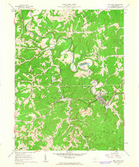
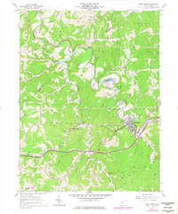
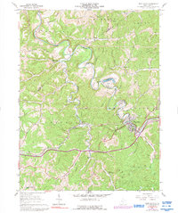
1961 Map of West Union
USGS Topo · Published 1963About this map
West Union serves as the focal point of this 1961 field-checked survey, situated where the Baltimore and Ohio railroad corridor follows the winding course of Middle Island Creek. The geography is defined by a dense network of narrow hollows and high ridges, including Mc Elroy Ridge and Haymond Ridge, which dictated the placement of early settlements and transport routes.
Find a feature on this map
49 named features on this map. Tap any name to fly to it.
Don’t see what you’re looking for? This feature index may not catch every label — zoom into the map to look around manually.
Map Details
Editions of this 1961 West Union Map
3 editions found
Other maps of this area

1904 · Vadis
USGS Topo · 1:62,500

1905 · Centerpoint
USGS Topo · 1:62,500

1905 · West Union
USGS Topo · 1:62,500

1906 · Holbrook
USGS Topo · 1:62,500

1924 · Centerpoint
USGS Topo · 1:62,500

1924 · West Union
USGS Topo · 1:62,500

1924 · Holbrook
USGS Topo · 1:62,500

1925 · Centerpoint
USGS Topo · 1:62,500

1925 · Vadis
USGS Topo · 1:62,500

1926 · Holbrook
USGS Topo · 1:62,500