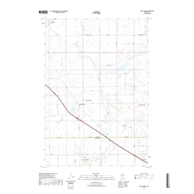
2019 Map of West Union
USGS Topo · Published 2019About this map
The West Union settlement serves as a central point in this northern landscape, where the prairie meets the intricate hydrography of the Sauk River watershed. The terrain is defined by its glacial history, evidenced by numerous water bodies including West Union Lake, Guernsey Lake, and the southeastern reaches of Lake Osakis. The boundary between Todd and Stearns counties, marked by Stearns Line Rd, cuts through a patchwork of agricultural sections and natural drainage features like Silver Cr and Ashley Cr. Genealogists will find several notable burial sites across the townships, including Elim Cem in the north and Sauk Valley Cem near the river. The concentration of wetlands and small lakes like Slough Lake illustrates the characteristic topography of the region, where roads often deviate to navigate around low-lying marshlands.
Find a feature on this map
40 named features on this map. Tap any name to fly to it.
Don’t see what you’re looking for? This feature index may not catch every label — zoom into the map to look around manually.
Map Details
Editions of this 2019 West Union Map
This is the sole edition of this map. No revisions or reprints were ever made.
Other maps of this area

1953 · Saint Cloud
USGS Topo · 1:250,000

1957 · Saint Cloud
USGS Topo · 1:250,000

1958 · Saint Cloud
USGS Topo · 1:250,000

1965 · Westport
USGS Topo · 1:24,000

1965 · Sauk Centre
USGS Topo · 1:24,000

1965 · Raymond Lake
USGS Topo · 1:24,000

1966 · West Union
USGS Topo · 1:24,000

1966 · Osakis
USGS Topo · 1:24,000
1966 · Sauk Lake
USGS Topo · 1:24,000

1966 · Lake Osakis East
USGS Topo · 1:24,000