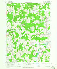
1964 Map of West Valley
USGS Topo · Published 1965About this map
Riceville and West Valley sit within a landscape of carved creek valleys and prominent rises like Bread Loaf Hill and Burns Hill during the mid-1960s. The region is defined by its rural infrastructure, where a network of gravel roads connects small settlements and isolated farmsteads. Numerous family and community burial grounds, such as Mt Hope Cem and Helland Cem, are scattered across the terrain, offering significant data for genealogical research in Ashford and Yorkshire townships. The local economy and geography are further shaped by water features and transit, including the Ischua Creek Dam and the rail-oriented Beaver Siding. This survey is particularly useful for identifying historical property boundaries and field lines, which are indicated by fine dashed markings derived from 1962 aerial photography.
Find a feature on this map
49 named features on this map. Tap any name to fly to it.
Don’t see what you’re looking for? This feature index may not catch every label — zoom into the map to look around manually.
Map Details
Editions of this 1964 West Valley Map
2 editions found
Other maps of this area

1923 · Arcade
USGS Topo · 1:62,500

1924 · Ellicottville
USGS Topo · 1:62,500

1924 · Franklinville
USGS Topo · 1:62,500

1925 · Springville
USGS Topo · 1:62,500

1925 · Arcade
USGS Topo · 1:62,500

1941 · Ellicottville
USGS Topo · 1:62,500

1942 · Franklinville
USGS Topo · 1:62,500
1954 · Springville
USGS Topo · 1:24,000

1957 · Sardinia
USGS Topo · 1:24,000

1960 · Buffalo
USGS Topo · 1:250,000