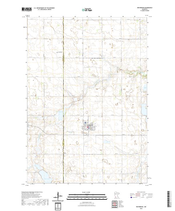
2022 Map of Westbrook
USGS Topo · Published 2022About this map
Westbrook serves as the primary hub of this Southwestern Minnesota landscape, situated at the intersection of several county routes and local streets like Davis Ave and Birch Ave. The surrounding terrain is defined by a series of shallow basins and meandering waterways, most notably the Dutch Charley Cr which winds through the southern half of the quadrangle. The agricultural character of the region is punctuated by prominent water features, including Lake Julia and Lake Louisa, as well as the significant Snow Lakebed to the north, suggesting a landscape shaped by historical drainage and fluctuating water levels.
Find a feature on this map
56 named features on this map. Tap any name to fly to it.
Don’t see what you’re looking for? This feature index may not catch every label — zoom into the map to look around manually.
Map Details
Editions of this 2022 Westbrook Map
This is the sole edition of this map. No revisions or reprints were ever made.
Other maps of this area

1953 · New Ulm
USGS Topo · 1:250,000

1954 · Fairmont
USGS Topo · 1:250,000

1957 · New Ulm
USGS Topo · 1:250,000

1958 · New Ulm
USGS Topo · 1:250,000

1958 · Fairmont
USGS Topo · 1:250,000

1967 · New Ulm
USGS Topo · 1:250,000

1967 · Walnut Grove
USGS Topo · 1:24,000

1967 · Tracy East
USGS Topo · 1:24,000

1967 · Storden
USGS Topo · 1:24,000

1967 · Dovray
USGS Topo · 1:24,000